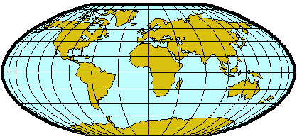
BACKGROUND:
The land is usually divided into climatic
zones which refer to the general overall weather in the region. These climate
zones also take into consideration precipitation, temperature, type of
vegetation it can support, and other factors. On the figure included in this
lesson, the following divisions can be defined:
- Tundra (cold, with little
vegetation, high precipitation)
- Boreal forest (cold, forest, high precipitation)
- Temperate (moderate temperature)
- Desert (dry climate,
little vegetation)
- Savannah (moderate precipitation, grassland)
- Steppe
(cool climate; little vegetation)
- Tropical Rain Forest (warm, high
precipitation, forest)
- Ice caps (cold, snow, no vegetation).
On the ocean there are also east-west
trending zones which can be divided into polar, subpolar, temperate,
subtropical, trades, equatorial, and monsoons. These surface waters affect the
local climate, especially in the intensity and duration of wind. When there
are unusual warm or cold waters in the ocean, they cause the air masses to
move in different direction which can change the weather patterns severely. El
Nino, a periodic condition of a warming of the waters in the Pacific is one of
these phenomena.
In polar ocean area ice occurs at
the surface most of the year and surface temperatures are at or near the
freezing point. In winter there is little direct sunlight. In subpolar
regions sea ice is seasonal, and may disappear in the summer. Surface
water temperatures may rise to 5ºC. The temperate regions correspond
to westerly winds where there are severe storms. Heavy precipitation and
strong seas are present. In subtropical regions the winds are weak and
surface currents are not strong. Clear skies, dry air, and abundant sunshine
creates a high evaporation rate. In equatorial regions surface waters
are warm with warm, moist air that produces high precipitation.
PROCEDURE:
- Go over the background information with
students. The inflatable world globe with biomes on it also defines the
different climatic zones. Students should look at the globe to find the limits
of each region that you discussed.
- With the information have them design a
way to show this information on the worksheet. You may want to give them
clues, that color coding the information will help make a reader see areas
that are warm versus cool easy. Basically, students make a color coded legend
and color the appropriate region.
Climate Diagnostic Center of the National
Oceanographic and Atmospheric Agency. You may want to see if this years
climate actually coincides with this generalized pattern