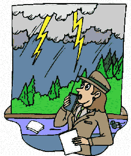
BACKGROUND:
Atmospheric pressure moves weather systems.
Cold air is more dense than warm air causing what is called high pressure.
Warm air which is lighter cause low pressure. In the area of higher pressure
the air molecules are closer together than they are in an area of lower
pressure. Air that is warmed exerts less pressure on the ground creating a low
pressure region. Cold air when it is over the oceans will actually depress the
sea level in that area; warm air will elevate the sea level.
Cold air is denser and heavier and pushes
the warmer, lighter air upward. Depending on how the warmer air is pushed will
depend upon how big the "fight" will be. Where these two air masses
meet is called a "front." How these different fronts meet cause
weather patterns to change. Remember there are many temperature variations of
"cold" air and "warm" air, resulting in many weather
types.
Fronts form when air masses collide, for
air masses do not mix unless they are similar in temperature and moisture
content. When warm air displaces cold air at the ground, the front is referred
to as a warm front. When cold air replaces warm air at the ground the front is
referred to as a cold front.
Vilhelm Bjerknes (1862-1951), a Norweigian
meteorologist discovered the existence of a distinct air mass that did not
mix, which he called a boundary front. His observations and recordings lead
other meteorologists to begin understanding how fronts are caused and moved.
PROCEDURE:
- Looking at the worksheet, "Cold Front"
refers to cold air pushing hard into warm air. The type of weather created
would include showers and thunderstorms. This is called a cold front.
"Warm Front" refers to warm air gently wedging under cold air.
Widespread clouds with rain for a long duration is the prevalent weather,
although it is highly erratic. This is called a warm front. Students should
label the area between the two masses as the front in each diagram.
- Read the following information about warm and cold
fronts to students. They should then try to draw this information on the
worksheet. If your students do not remember the different types of clouds, you
may want to review cloud types with them.
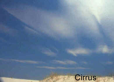
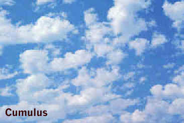
Cirrus are high clouds which are wispy, icy clouds.
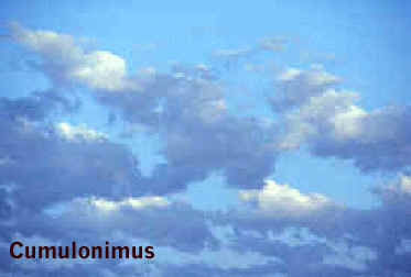
Cumulus or puffy clouds are mid level clouds that are packed close together.
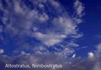
Stratus clouds are a long uniform layer of clouds resembling fog but not
resting on the ground. Nimbus when used with a cloud name refers to a dark
cloud usually meaning rain.
WARM FRONT:
Warm, moist air from the tropics slides over a wedge
of cold polar air. As the warm air moves over the cold air. Wispy cirrus
clouds form and a milky veil of cirrostratus clouds can be seen. Above the
base of the front, clouds thicken first with altostratus above great, gray
nimbostratus clouds. A rain storm falls in the cold sector beneath the
front.
COLD FRONT:
Thickening cumulus clouds warn of the coming cold front,
where cold polar air cuts in sharply beneath the warm, moist tropical air. The
cold front slopes much more steeply than the warm front, and strong updrafts
can stir up violent storms. Huge cumulonimbus many build up all along the
front, bring heavy rain and sometimes thunderstorms as it passes over.