BACKGROUND:
The ocean system is complicated. The
water in the oceans is salty because as the surrounding rocks erode(land and
under the oceans). Erosion causes the release the minerals and elements that make up the rocks.
The minerals are dissolved in water and are in solution until either
chemical or biological reactions in the oceans precipitate the minerals.
For instance, radiolarians, a marine protozoa, can take Si + O dissolved
in the marine water and create a siliceous skeleton of a water-based quartz
(opaline SiO2+ H2O).
Erosion of the land also brings sediments
to the oceans bottoms via rivers. The sediments drape the landscape
of the oceans bottoms, sometimes hiding the topography of the oceans
floors. The topography of the ocean floor is as varied as the continental
topography.
Although we have known that the underwater
topography (bathymetry) is varied since the 1870's, most people do not even think about
the seafloor. Students always see water and think that the bottom
is like a bowl, smooth and curved. It has been determined that the
ocean basins have an average depth of almost four kilometers. Other topographic
highs include the mountainous ocean ridges, deep-sea trenches, jagged,
linear fracture zones, abyssal hills, and seamounts.
The continents are just the highest of the ridges. Sea level is just
the arbitrary point at which the oceans meet the land. Above sea
level we call it topography and below is called bathymetry. Topography
is measured as positive height, whereby bathymetry goes deeper from sea
level.
PROCEDURE:
- Discuss with students the
physical shape of the ocean's floor, pointing out that 70-71% of the surface
of the Earth is covered with water. Valleys and mountains can be
found below the water. Use the physiographic hydrologic globe to
show students the bottom of the oceans. The oceans are really just
land that is lower than sea level. Use the worksheet on the
oceans basins to see if you can find the ridges and trenches.
- Many elements are dissolved in seawater.
You may want students to guess which elements are in water. Use the
worksheet on Elements in Seawater to illustrate which ones are
dissolved in seawater. Students will be surprised that there are
so many elements. Some of these elements come out of solution in
various forms which can be used for economic purposes. Students in
lab will see manganese nodules which are potato-size masses of manganese,
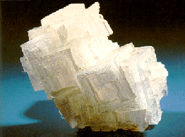
cobalt, and nickel. Salt is also produced by solar evaporation of
salt ponds, that precipitate sodium chloride.
- Answers:
- H, Na, Mg, K, Ca,
C, O, S, Cl, Br;
- Sr, B, Si, F
- He, Ne, Ar,
Kr, Xe, Rn, N, and O
- oxygen
- Pacific, Bering, Canada,
Siberia, Eurasia, Greenland, Labrador, NFD, Wes Europe, Norway, North America,
Iberia, Canary, Cape Verde, S. Leone, Mexico, Yucatan, Caribbeam, Guatemala,
Peru, Chile, Bellingshausen, Argentine, Brazil, Guiana, Guinea, Angola,
Cape, Agulnas, Mozambique, Weddell, Crozet, Somali, Mascarene, Arabian,
Bengal, Wharton, Australia, Wilkes, Tasman, Philippine, South Cina, Japan,
Okhotsk
- Atlantic, mid-Atlantic Ridge
- Fracture
zones caused by uneven movement of the crust.
|