BACKGROUND:
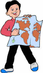
 A map is a picture or representation of the Earth's surface. Maps show
how things are related to each other by distance (both horizontal and
vertical), direction, and size. Maps are a way of showing many things about
a portion of the Earth's real three dimensional surface on a flat piece of
paper. This two dimensional representation can be carried and transported
easily. A map is a picture or representation of the Earth's surface. Maps show
how things are related to each other by distance (both horizontal and
vertical), direction, and size. Maps are a way of showing many things about
a portion of the Earth's real three dimensional surface on a flat piece of
paper. This two dimensional representation can be carried and transported
easily.
A map is not a picture of the Earth's surface. Map can focus on one
feature, such as streets or population distribution. Maps can show many
things that pictures cannot show.
Maps have many uses. They are important in the appraisal, conservation,
and development of natural resources; in analyzing and forecasting weather
conditions; in agriculture, fisheries, and general commerce; in regional
planning; and in property surveys and the demarcation of boundaries. Maps
help in navigation by sea, air, and land in times of peace and especially in
times of war. Maps are also important to scientists concerned with the
causes and effects of Earth surface phenomena, in such disciplines as
geology, oceanography, meteorology, climatology, animal and plant ecology,
agronomy, economics and the social sciences, as well as geography itself.
Maps record observations, aid in analysis, stimulate ideas and aid in the
formulation of working hypotheses.
PROCEDURE:
- Discuss the meaning of maps with the students.
- Give the students a World Placemat and ask them why
is a map important. Hopefully they will point out that you can find
countries, roads, cities, forests, oceans, lakes, and many other natural
surfaces without going there.
- As a homework assignment, have students find
different types of maps. Newspapers are a good source, or have them look
on the Internet. Have the students determine what the maps are used for.
Here are examples of the type of maps students may find:
POLITICAL MAPS - locate a country, city, or
state
WEATHER MAPS - see how the weather fronts are moving into an area
DISASTER MAPS - locate scenes of problem
ROAD MAPS - help people locate a business that might be advertising in
a newspaper
After students bring in the maps, discuss what
they have found. This will help the students see the broad range of uses
that maps have in our society.
- Here are some websites that have good map
resources:
http://fermi.jhuapl.edu/states/states.html
The Color Landform Atlas of the United States. Beautiful shaded 3D maps
showing surface features
http://www.ngdc.noaa.gov/mgg/
Good maps of the seafloor, from NOAA.
http://www.100topmapsites.com/
A link site that connects to many commercial, educational, and
government map sources.
|