| CREATING LANDFORMS You
have learned about different landforms caused by wind, rain, ice, and
tectonic activity. Each has it own characteristics. Wind
smooths an area by sandblasting the surface of rocks. Rain erodes rock
and soil as it races downslope. Ice slowly cuts and grinds large
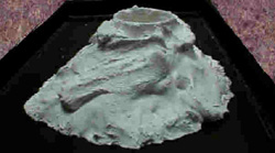
mountains as it moves. Volcanoes produce lava that covers everything
in its path. The picture on the right is a student example of lava
using plaster of Paris.
Using clay or plaster of
Paris, mold a landform that you have read and try and make it
realistic. If you have questions about what the landform should look
like refer back to the reader and topographic maps. |