| LANDFORMS AND TOPOGRAPHIC
MAPS
Running
water along rivers, streams, or creeks can cause
valleys with a "V" shape. Water cuts along a center line as
it erodes the rocks and soil as the water flows over. As soon
as the water in a river erodes the Earths surface, the river it
also wants to deposit the sediment it created. If the energy in
the water is high enough, the sediment will continue to stay in the
water. However, if the water slows down, the sediment will drop out or
be deposited because there is not enough energy to hold the sediment
in the water. This process of eroding and depositing is called weathering.
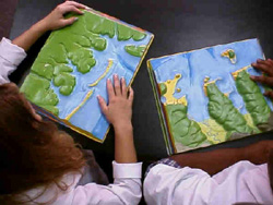
A topographic map can help identify landforms if
you can interpret the contours. Look at the contours that reflect a coastline
on Quick Activity - Interpreting Contours.
Contours can help us a three-dimensional world on a flat piece of
paper! |
 |