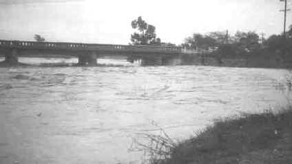
15 Square Miles Under Water in Alvarado Area

by Paul Lewis, Oakland Tribune

December 25, 1955

Nothing but the tan, muddy water moved yesterday over a 15 square mile stretch of flooded farmland close to the Bay in Southern Alameda County.

From the air, only orderly ranks of utility poles and an occasional fence line marked much of what had been rich farmland in the Alvarado area.

Miles-long fingers of the muddy water that poured through at least three breaks in the levee system reached as far east as the foothills at Niles.

Many miles of access roads were flooded and dozens of farming community families were evacuated by the Alameda County Sheriff’s Department.

400-FOOT WATER HAZARD

The muddy water lapped up to the edge of State Highway 9 running through Niles. At one point the water crossed a 400 foot stretch of the major highway, forcing a long line of cars to run bumper to bumper, hubcap deep.

The Pacific States Steel Company plant at Niles was a tall island standing isolated from the roads around it by at least two feet of water.

A large concrete pipe plant stood similarly isolated on the outskirts of Alvarado.

Water lapped at the edges of about two dozen newly occupied homes in a subdivision south-west of Niles.

The water pouring through the levee breaks looked like miniature falls. Alvarado Creek and the Bay poured through the breaks at isolated points close to the Bay.


Difficult Trek

To get to them, men would have to walk on the tops of the dikes about two miles, at points only a few inches from the lapping water.

But the worst of the damage, and the most costly, is visible only beneath the roiled water.

Farm Bureau spokesmen said the brine waters of the Bay will reduce the value of much of the farmland for a long time.

Reconstituting the soil will require extensive and expensive treatment.

Meanwhile, until the flood waters subside, only the vacant farmhouses and files of poles and fences give evidence of human habitation in Alameda County’s surviving farmland area.


Niles Engulfed by Rampaging Creek

Flood hits Niles


December 25, 1955

The Niles flood hit about 5:30 p. m. when the Alameda Creek overflowed its banks west of the California Nursery.

Within an hour more than 300 homes... Most of them new ranch style buildings in the $20,000 bracket .... were standing in as much as four to five feet of water.

No casualties were reported. Several thousand persons fled in private cars, or were evacuated to an emergency center at the Washington Union High School in Centerville by school busses and trucks.

The downtown section of Niles was spared the lapping waters which concentrated in a pocket between School St. on the edge of town and the Niles-Alvarado Road.


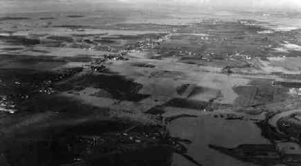
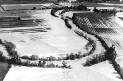
Overview of 1955 Flood (Coyote Hills are in the background)

Mission Blvd. at Niles Canyon 1955


Lower portion of Alameda Creek (Alvarado) 1955