|
|
|
|
|
|
|
|
|
|
Create a 3 dimensional model of a local watershed. |
|
OBJECTIVES:
VOCABULARY:
MATERIALS:
There are three indicators
of wetlands that include the presence of water, soil development under
aquatic conditions, and the presence of wetland plants. Water can be
caused by run-off or ground water and is available during the growing
season.
Wetlands are important for
biological life because it sustains a diversity of organisms throughout
the year. Wetlands provide rest stops for migrating animals like birds.
Wetlands also filter and clean storm water from pollutants. Different
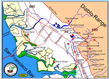
wetlands fill different functions in an ecosystem. Tyson Lagoon is a
permanent, freshwater wetland, whereas the other areas that contain water
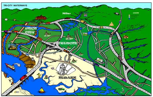
only during the rainy season are considered seasonal wetlands. Watersheds naturally clean themselves as water can be filtered as it flows through wetlands. Water that migrates through the different levels of the watershed nourishes biological life. However, we sometimes pollute these wetlands by discharging industrial or municipal waste into the watershed (point source pollution). This overloads the system and pollution of toxic substances may increases. Even small amounts of pollution (non point pollution) can accumulate and cause significant damage. Our watersheds reflect the health of our environment. PROCEDURE: 1. Show students the local watershed map and see if the students can recognize the different areas. (http://msnucleus.org/watersheds/index.html)
2.
Open up the watersheds powerpoint to the first slide (map of tri-City
area). Hand out the placemat of
the Tri-City Area. Ask the
students to find the following places, by putting their finger.
Walk around and check that they correctly have found the areas.
3.
Go over the rest of the Watersheds powerpoint.
(Slides 2-8). These slides
define watersheds and end up back with the tri-city map.
Have students outline the Mowry Slough Watershed, Laguna Creek
Watershed, and Alameda Creek watersheds on the map.
4.
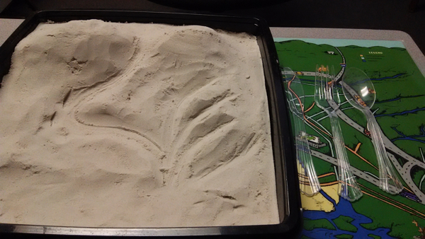
Hand
out the shape it trays so students can create their own watershed.
Ideally 2 -3 students can work on a project.
Students should produce something that is hilling and forms a
network of streams (called
dendritic pattern). The
watershed is defined as gravity acting on an area to bring all the water
and debris downward.
|


 Wetlands can be various
sizes and shapes, with either freshwater, brackish water, or marine water
for a portion or an entire year. Marshy, boggy, or swampy areas also
qualify as wetlands.
Wetlands can be various
sizes and shapes, with either freshwater, brackish water, or marine water
for a portion or an entire year. Marshy, boggy, or swampy areas also
qualify as wetlands.