BACKGROUND:
Knowing the basic geographic features of the Earths surface is very
important in science. Students should first learn that the Earth is roughly
spherical in shape, like a ball. They should next learn that the Earths
two main surface features are continents (land) and oceans (water).
Students should remember that water, including oceans, lakes, and
streams, cover the land in low areas. It is also important that students
begin to understand that the bottom of the ocean is not flat like the bottom
of a bowl. The ocean floor does have flat parts, but there are many
mountains and valleys, just like on land. Islands are really the tips of
underwater mountains. The land above and below the water are actually
somewhat different in composition. Geologists distinguish these as
"continental crust" (the land above water) and
"oceanic crust" (the land below water). The students will
learn more about the crust in the Rock Cycle and Plate Tectonic Cycle parts
of this curriculum.
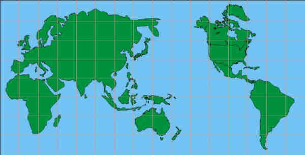
Another important aspect of maps is naming locations on the Earths
surface. "Continent" and "ocean" are two examples of the
names of physical features. The individual continents and oceans are also
named.
PROCEDURE:
- Explain the concepts of land and water to the class. Some of the
children may not be familiar with the ocean, so you may have to show
them pictures to emphasize what an ocean is. Show pictures of land with
mountains, or you may want to go outside to emphasize that we walk on
land. Make sure the students understand that land extends under the
water, and that the ocean floor is not flat.
- Show the children a globe of the Earths surface. Explain that the
globe shows the "real" shape of the Earth. Emphasize that the
globe is only a model of the Earth, because the planet is too large to
make a full-size representation. You may wish to have additional globes
and maps available, so the students can see a variety of different types
of models of the Earth.
- Point out the different continents on the globe. A continent is a
large land mass, mainly surrounded by water. You may want to give
students some clues on each of the continents.
Africa is a continent that has elephants, tigers, lions, and camels
that roam in some of the countries.
South America is a continent that has llamas, tropical rain forest,
and the longest river in the world, the Amazon.
North America is a continent that includes the United States, and is
home to the buffalo, horses, and rabbits.
Australia is a continent that has animals like kangaroos, koala
bears, and platypuses. It almost looks like a big island.
Antarctica is a continent that is full of ice with penguins roaming
the ice.
EurAsia is a big continent that includes Europe, Asia, and India.
Many people separate Europe and Asia, but it is only a political
boundary.
- Tell them that they are going to throw the Earth around! Have the
students sit in a circle. Have the students take turns tossing the
inflatable globe to one another. Have the student who catches the globe
look under his or her right hand, and say whether they found land or
water. After everyone has a chance, you may want to repeat the exercise
using the words continent and ocean, or the names of the continents.
|