BACKGROUND:
The Earth's landscape is influenced by many forces,
including water, ice, and wind. Plate Tectonics
or the movement of the Earth's crust is also very important as it creates
volcanoes, mountains, and valleys. Students should understand that one of the
ways that the Earth differs from the other planets is the effects of these
three forces on its surface. Liquid water is the most important agent of
weathering, erosion, and transport on the Earths surface. As water runs
downhill, it carves valleys, transports loose material, and fills in low
areas. Most of the Earths surface is in fact covered by stream valleys. Landslides, which are downhill movements of large masses of loose rock and
soil, are also common in areas of running water. Water adds lubrication to
loose material, making landslides easier to move.
Solid water, or ice, is an effective agent where it is
cold, including mountainous areas (high altitudes) and near the poles (high
latitudes). As they move downhill, glaciers and icecaps act like giant sheets
of sandpaper or like files. They can carve away both loose material and
solid rock. Mountain glaciers carve deep valleys. Ice sheets, like the ones
covering Antarctica and Greenland, flatten landscapes by grinding away all
the high areas.
Wind is only powerful enough to erode and transport
dust- and sand-sized material. Larger particles only move during
catastrophic storms. Although winds blow over much of the Earths surface,
the effects of the wind are best visible in arid, or desert regions. Here
the effects of water are subdued, and the wind can pile up sand dunes and
blow dust for long distances. For this reason, deserts and wind activity are
often equated. This is a reasonable approximation for students. Be aware
however, that winds are also strong enough in other areas, such as along
coastlines to form sand dunes and other "windy" landscapes.
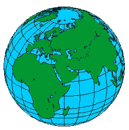
The globes also show lines of longitude and
latitude.
These are a system for locating a point on the Earths surface. Longitude
lines run from pole to pole. They increase in value eastward from the 0o
line, which run through England. Note that the 180o line,
halfway around the globe, is also the international date line. Latitude
lines run from east to west. The equator is the line of 0o
latitude. Lines of latitude increase in value toward the North and South
Poles, which are at 90o N and 90oS, respectively.
Every point on the Earths surface has a unique latitude and longitude
location.
In North America ice dominates the northern portion of
Canada, portions of Alaska, and Greenland. Water is the main influence
wherever there are rivers. Desert-like areas are present in the American
southwest and portions of Mexico. Central America, and most of northern
South America are dominated by water. There are many deserts in South
America, especially in portions of Chile and Argentina. In the southern tip
of South America, ice influences the landscape.
Africa is a continent that most people associate with
jungles. However, as the students look at the Inflatable World Globe, they
will notice that northern Africa is dominated by desert. A wide band of
river-dominated area occurs in central Africa; some of this is true jungle.
The southern part of Africa is a mixture of river and desert areas.
The European portion of the Eurasian continent is
dominated by rivers, so again water is the major factor. In some areas of the
northern Eurasian continent, ice dominates. In the central portion of the
Eurasian continent, desert is very common.
Australia is dominated by a desert-like climate, so
wind is important. Antarctica on the other hand is dominated by ice.
In terms of patterns, students should be able to see
that areas at high latitudes are dominated by ice. In addition, they may
also notice that desert areas occur in two bands, located 30o-40o
north and south of the equator.
PROCEDURE:
- Introduce students to the forces of wind, water, and ice. Explain that
they will be examining the inflatable globes to try and learn the
distribution of these forces on the Earths surface. Discuss how
Plate Tectonics can move the surface of the Earth, either by volcanoes
or faulting.
- Point out the longitude and latitude lines on the globes. Explain
their meaning to the class. You may wish to find the latitude and
longitude of your location, and have the students try and find it on
their globes.
- The following provides information on each of the models in the
Landform Model kit.
-
| Volcano Model: formed mainly by plate
tectonics |
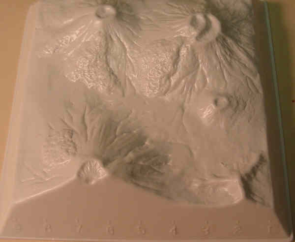 |
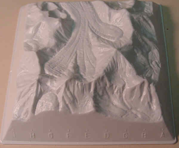 |
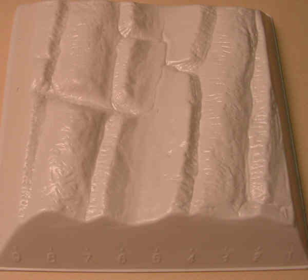
Mountains with Glaciers Model: these
valleys are formed mainly by ice carving the valleys |
| Uplifted Mountains: Faults caused one side
to be uplifted, but the incised valleys are caused by water
eroding the mountains after plate tectonics. |
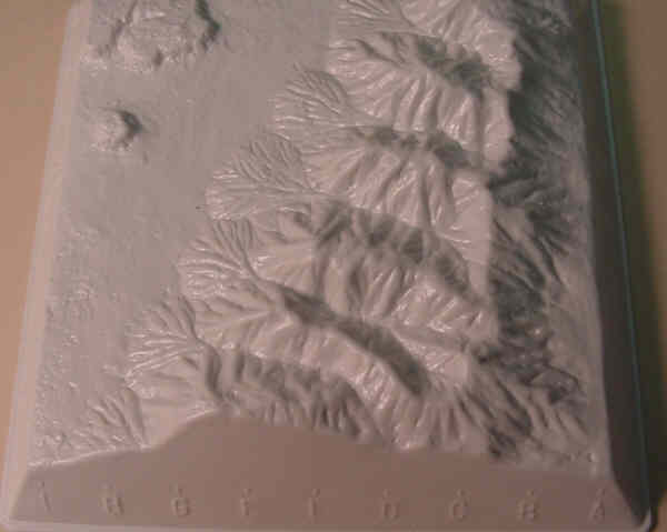 |
 |
Folded Mountains: Plate tectonics
(converging plates) caused folding, but water or wind could have
eroded the mountains and valleys smooth. |
In Exercise 3, the students take information from the globe and
transfer it to the worksheet. Have them color the continents
appropriately. Make plenty of allowance for interpretation in their
answers.