BACKGROUND:
According to the theory of plate tectonics, the
Earth's crust and upper mantle are broken into moving plates of
"lithosphere." The Earth has two types of crust. Continental crust
underlies much of the Earths land surface. The ocean floors are underlain
by oceanic crust. These materials have different compositions. Continental
crust is less dense than oceanic crust.
All of the plates are moving. They are slow, moving at
speeds of centimeters to tens of centimeters per year. They slide along on
top of an underlying mantle layer called the asthenosphere, which is
composed of a less rigid, almost viscous rock.
The plates are layers of rigid, solid rock. As they
move, plates interact at their edges or boundaries. There are three basic
directions or types of boundary interactions. In some places, two plates
move apart from each other; this is called a diverging plate boundary.
Elsewhere two plate move together called a converging plate boundary.
Finally, plates can also slide past each other horizontally. This is called
a transform plate boundary.
Volcanoes and earthquakes help define the boundaries
between the plates. Volcanoes form mostly at converging and diverging plate
boundaries, where much magma is generated. Earthquakes occur at all three
types of boundaries. Because the plates are rigid, they tend to stick
together, even though they are constantly moving. When the strength of the
rocks at the plate boundary is exceeded, they move rapidly, "catching
up" with the rest of the plates. We feel this release of energy as an
earthquake.
PROCEDURE:
This exercise focuses on allowing the students to put the information
that they have learned in previous years into perspective.
-
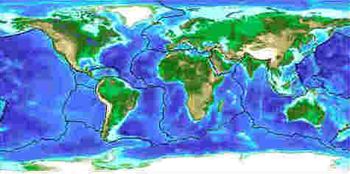
Show the students a world map with either plate boundaries or plots of
Earthquakes and Volcanoes. The U.S. Geological Survey publishes a map
called the "Dynamic Earth," that would be very useful. Point
out the different plate boundaries to the class. These boundaries are
not sharp lines but zones where the movement takes place. The lines on
the map are just approximations. A relief map of the Earth, shows that
mountain ranges seem to following the earthquake and volcano pattern.
-
Review the three ways plates move with the class. Draw pictures on the
board like the ones at the top of the second image below, or use the
image itself.
-
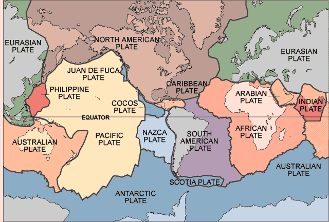
The plates were defined and named by geologists. Most of these
scientists agree that there are 13 large plates, and many smaller ones.
The exact total is not agreed upon. During lab, students will look at
the data and decide for themselves if there are 13 plates or not. Using
the worksheet, have the students make up names for the individual plates
shown on the map. As a class, compare the students names with the
real names of the plates, which are listed below.