BACKGROUND:
The plates are composed of rigid, solid rock. As they
move, plates interact at their edges or boundaries. As discussed in the Pre
Lab and Lab, there are three basic directions or types of boundary
interactions. In some places, two plates move apart from each other; this is
called a diverging plate boundary. Elsewhere two plate move together; this
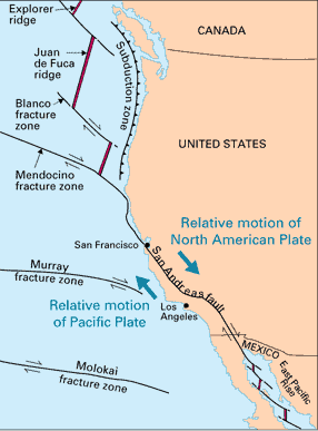
is a converging plate boundary. Finally plates can also slide past each
other horizontally. This is called a transform plate boundary. Volcanoes and
earthquakes help define the boundaries between the plates. Volcanoes form
mostly at converging and diverging plate boundaries, where much magma is
generated. Earthquakes occur at all three types of boundaries. Because the
plates are rigid, they tend to stick together, even though they are
constantly moving. When the strength of the rocks at the plate boundary is
exceeded, they move rapidly, "catching up" with the rest of the
plates. We feel this release of energy as an earthquake.
In this exercise, the students will color and assemble
a map of the Earth showing earthquakes. The assembled map will make is a
tetrahedron (a four-sided geometric figure) of the Earth. This map was
designed by John Ward of the National Geophysical and Solar Terrestrial Data
Center (NGSDC). The NGSDC acquires, reformats, archives, and distributes
worldwide seismological data, many in cooperation with the U.S. Geological
Survey. The earthquakes that are plotted on this tetrahedron map were
retrieved from the Earthquake Data File for the years 1963-1974 and had
magnitudes of 4.5 or greater.
PROCEDURE:
- Before class make a copy of the tetrahedron for each student. Either
copy the master sheet onto hard stock paper (50 lb or heavier is ideal,
but 20 lb paper will work) or print it from your computer. This will
help students make a better model.
- Pass out the worksheets. Have the students lightly color the Earth,
distinguishing land from the oceans. See if they can define
"plates" using the data. Next, instruct them to draw in the
plate boundaries. Ask them this question again after they have assembled
the tetrahedron. It is much easier to see the plates when the puzzle is
put together.
- Have the students cut out the tetrahedron and paste it together,
gluing the appropriate areas. Make sure that they fold all the black
lines before they start to paste, otherwise it is difficult to put the
model together.
- Discuss the 3 different plate boundaries with the students.
Differentiate which boundaries produce earthquakes and/or volcanoes.
Converging and diverging boundaries both produce earthquakes. Only
earthquakes are common at transform boundaries. Draw pictures on the
board to reenforce these points, or use the presentation image below.