|
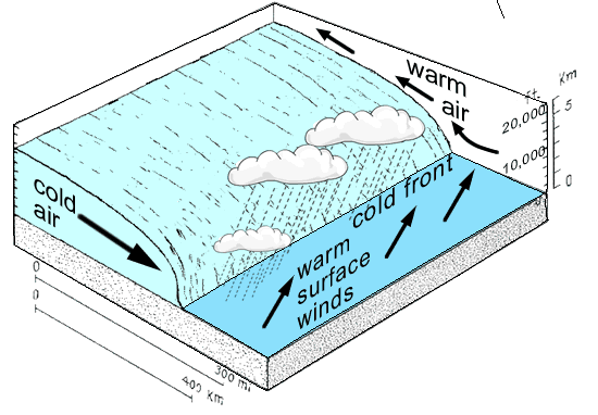
Thickening cumulus clouds warn of the coming
cold front. Cold polar air cuts in sharply beneath the warm, moist
tropical air. The cold air mass goes under the warm air mass at a steep
angle. Strong winds between the lower and upper air masses can cause
violent storms. Huge cumulonimbus many build up all along the front,
bring heavy rains and sometimes thunderstorms as it passes over.
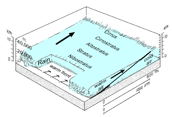
A warm front is when warm, moist air from
the tropics, slides over a wedge of cold polar air. As the warm air
moves over the cold air, wispy cirrus clouds form and a milky veil of
cirrostratus clouds can be seen. Above the base of the front, clouds
thicken first with altostratus above great, gray nimbostratus clouds. A
rain storm falls in the cold sector beneath the front.
|