|
Interpreting how the Earths sedimentary layers have formed, is
difficult. Cores taken on land and from the ocean are not only expensive
to retrieve, but represent a small percentage of the Earths surface.
Methods using seismic waves developed in the 1960's help to
observe the crusts layers in detail. Seismic stratigraphy is
when energy waves are used to bounce off the different layers of the
Earth. These layers provide us with data that a seismic stratigrapher
can then interpret. For example, in the seismic profile below we show
the results of waves bouncing off the different layers and then recorded
on the surface of the Earth. These "wavy" images can then be
used to reconstruct the area in rock units, as shown in the
interpretation of the seismic profile.
These advances have allowed geologists to map more area than ever
before. Prior to these advances, only outcrops and geologists
walking and recording on their maps could be used.
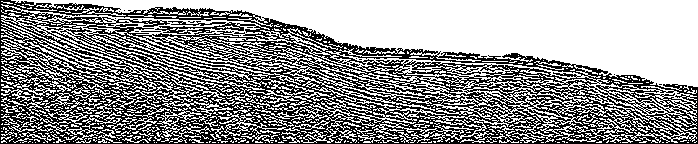
Seismic profile of an idealized area
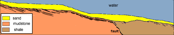
Interpretation of the ideal seismic profile
|