| One of the latest developments in oceanography is to use satellites
to study the ocean floor. Recently, a team of American scientists
combined data from European and US military satellites to produced
detailed sea floor maps. These maps are especially important because
they cover all of the Earths oceans, especially places where sonar
scans are scarce. They are also easier to obtain than sonar maps. Many
oil and mineral exploration companies, as well as governments, use
satellite maps of the sea floor.
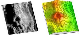
Sonar on the left and interpretation of undersea
volcano on the right |
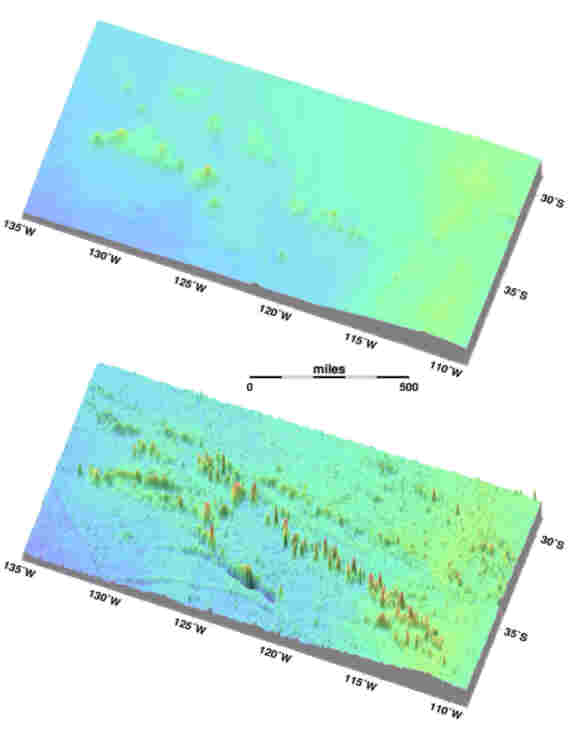
Interpretation from satellite data
|