| INTERPRETING LANDFORMS You have learned that a contour are lines of equal
elevation. Contours make it possible to tell where mountains and
valleys are located. They help us recognize the shape of the land. If
the contours are close together, the land rises quickly and the area
is steep. If the contours are far apart then the area is a gentle
slope.
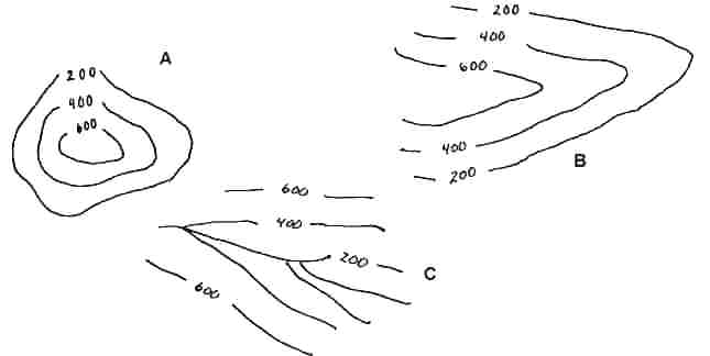
If you practice reading a contour
map, you can learn to visualize the topography in a glance. A hill or
mountain for example, is marked by high contours surrounded by lower
contours (figure A). A ridge has the higher contours inside the lower
contours (figure B). A valley or canyon has lower contours inside the
higher contours (figure C).
Complete the following lab sheet to
learn more about reading topographic maps with the maps provided by
your teacher.
|